Elevation - Global version
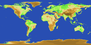
Global version elevation is elevation data at 1m interval covering the whole world.
- Summary
- Index Code
- Use of data
- Download ver1, ver2 West East
Summary
To date, data of two periods, i.e., Version 1 and Version 2, were developed and provided.
| Version 1 | Version 2 | |
|---|---|---|
| Data source | GTOPO30 | GMTED2010 GLCNMO (Sea & Water) |
| Coordinate system | WGS84 | WGS84 |
| Resolution | 30 arcseconds | 15 arcseconds |
| Data type | Byte (16bits) | Byte (16bits) |
Index Code
Elevation includes values at an interval of 1m
| Code | Class Name |
|---|---|
| number | Height (m) |
| -9999 | Water bodies |
| 9998 | No data |
Use of data
Use
Acknowledgement of written sources is necessary. Please show a text, "Geospatial Information Authority of Japan.", on your products.